contact us

Use the form on the right to contact us.

We'll answer as fast as we can, but please be patient as we're relying on public wifi to keep in touch!


123 Street Avenue, City Town, 99999

(123) 555-6789

email@address.com


You can set your address, phone number, email and site description in the settings tab.
Link to read me page with more information.

IMG_8412.JPG

blog

all but the cats write here ... to remember, to share, to mumble, to shout ... follow along by RSS or email if you like.

Filtering by Category: adventuring

Trying to Keep a Lid On It / Part 2

michael

Part One is pretty much required reading before you start this one. 


We arrived 20 minutes ahead of Kenny and Cynthia the next day. We had the plats by email. The power-line was part of the 15 acres. The ravine was part of the 31. The plot appeared to go to the peak. I ran to see if there was water in the ravine. None, but my guess was the stream went underground further back. I ran halfway to the peak. An old road bed cut the length of the land with trees about 9 inches in diameter springing out of it. Kenny and Cynthia were arriving. I ran back down the hill. The boys had been instructed 'No sword battles while we talk with the realtors' – which is how most of their time had been spent the last two days.

IMG_1651.JPG

Kenny and Cynthia were warm and friendly as we had expected and full of stories about the county, the people, the laws, and the way of life. We had enthralling conversation meandering the land for two hours. Age limitations kept us from going to the peak or down the ravine. Finally Kenny asked if we wanted to look at the 15 acre plot. We shook our heads, “No.” Both thinking 'not unless we can go the full perimeter.'
“Well, I have another plot I think you guys would like. It's about ten minutes away. D'ya wanna see it?”
“Sure! Let's go!” We got in Matilda and shut the doors.

20180318_145224.jpg

“I assume you said yes to be nice,” Bethany said, “and that we're coming back here to go to that peak.”
“Exactly!” I smiled.
“I like it three times as much as yesterday!” she glowed.
“Yesssss!” I said through my smile.
“But there's no stream!” Fynn piped from the back.
“I think there might be if we follow that ravine.”

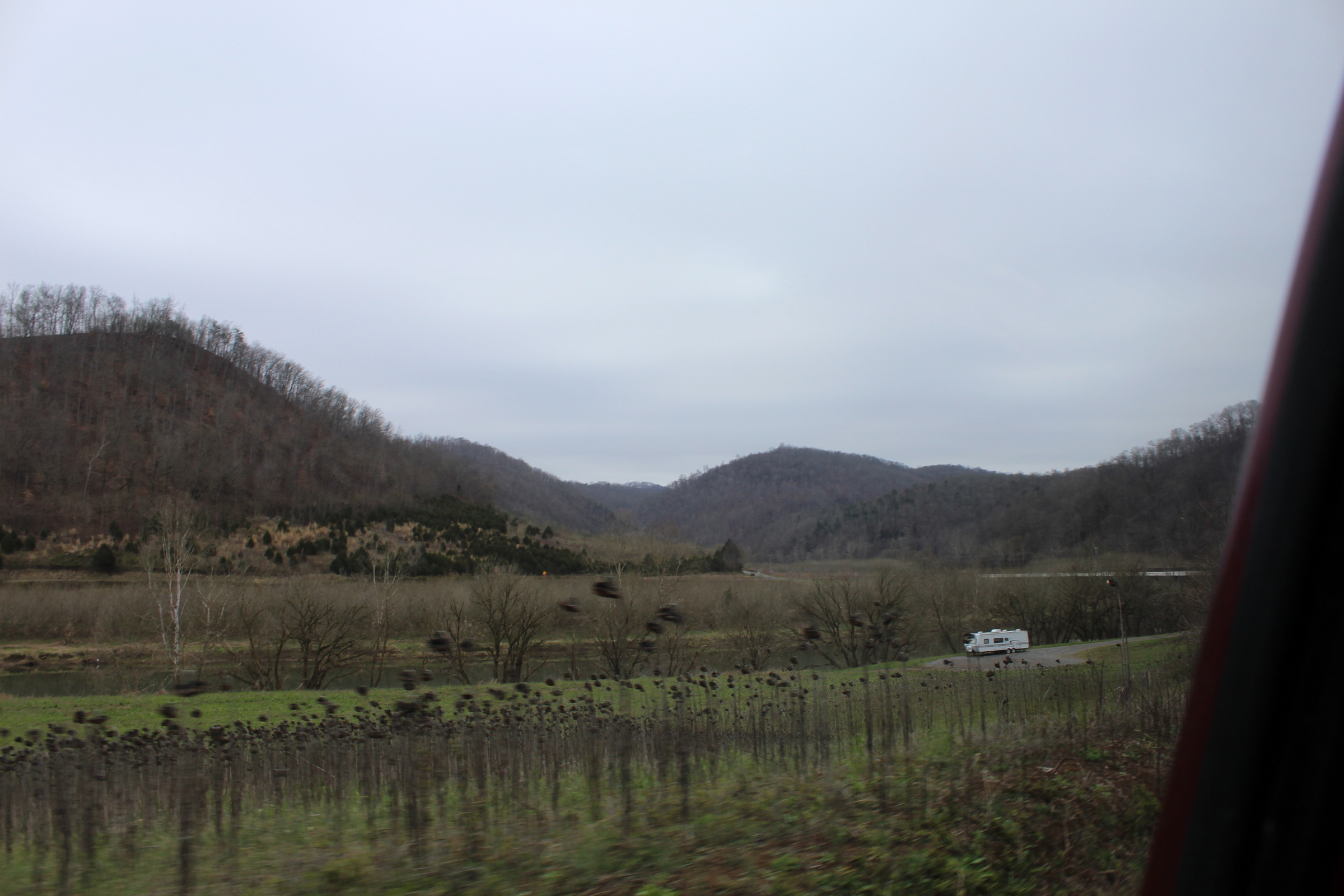
Kenny's “ten minutes” was a 45 minute tour of the back roads to Rogersville. We didn't mind. It was a gorgeous drive. After one pit-stop at a waterfall Cynthia thought the kids might like, we arrived at a wide open field sloping down to a rushing stream. Kenny's little car turned off into the field and putted up a small rise. I followed suit thinking 'We had a pretty heavy thundershower last night.' Sure enough, Matilda's 6500 lbs sunk right in, slithering to a standstill halfway up the rise. After Kenny called a friend to come tow us out, he showed us the land. It had a very nice stream. There was not much else to say about it.

20180318_163954.jpg

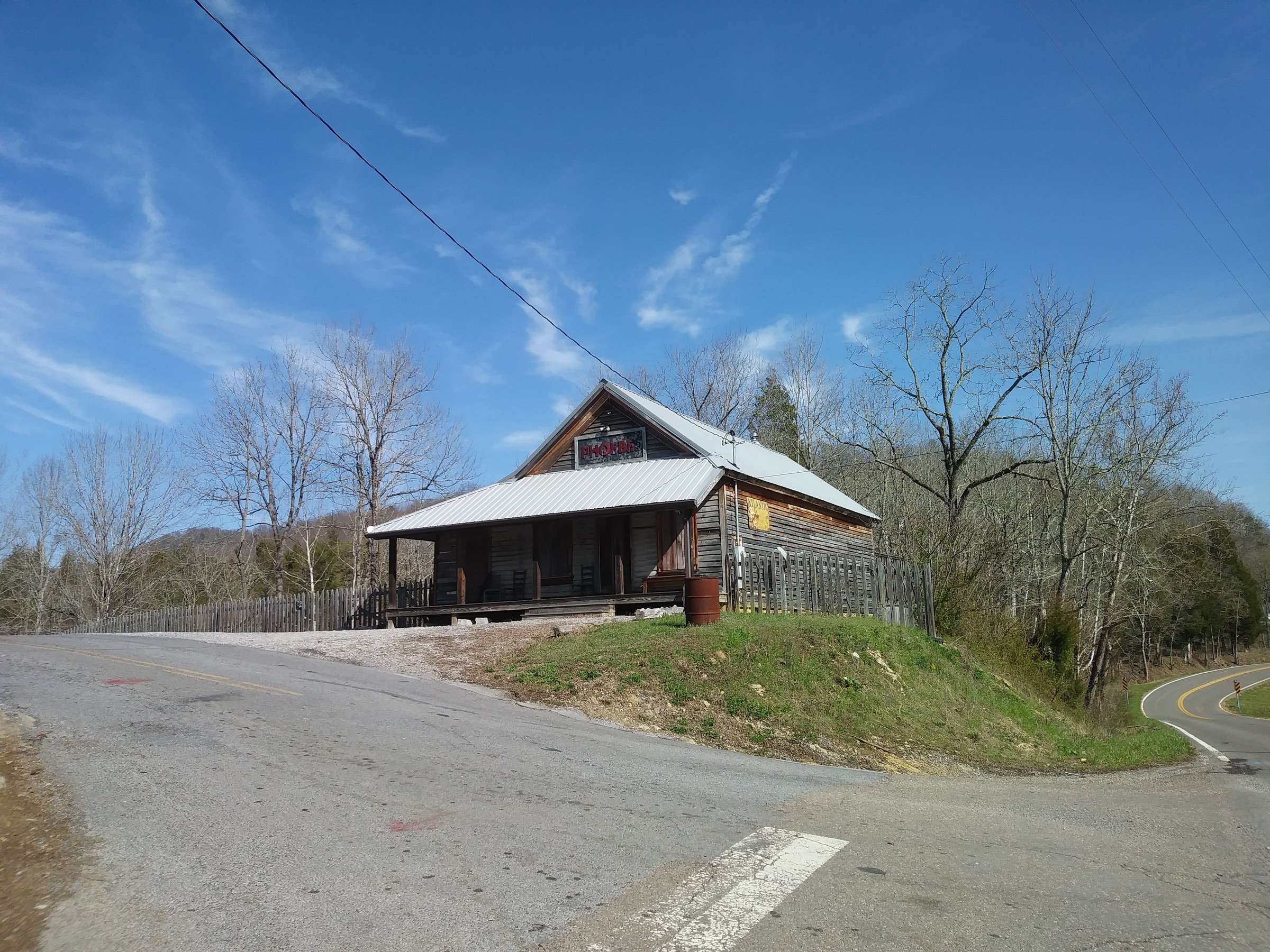
Then he took us up the road and showed us an old country store from the early 1900's that he and Cynthia bought and restored. The back seed room had been made into an apartment with floor to ceiling poplar. The main store area looked original, straight out of the soots, with an operational pot bellied stove between two long wide sales counters and antiques lining the shelves. The floor was rugged, untouched, mottled with tar from years of sprinkling kerosene to keep down the dust. It was stunning.

20180318_162716.jpg

By the time we got towed out it was too late to return to Clinch mountain. That evening, Fynn took apart an old remote control airplane, attached the propellers and receiver to a raft made of plastic bottles and steered it on the river from the dock. It worked better than the plane ever had. As we sat by the river, Bethany waxed on the property “It'd be a perfect place to make a pullout with coffee for people traveling Rt. 66.”

I laughed. “Yeah! I can just see us entertaining the Hell's Angels!”

MVIMG_20180317_181257.jpg


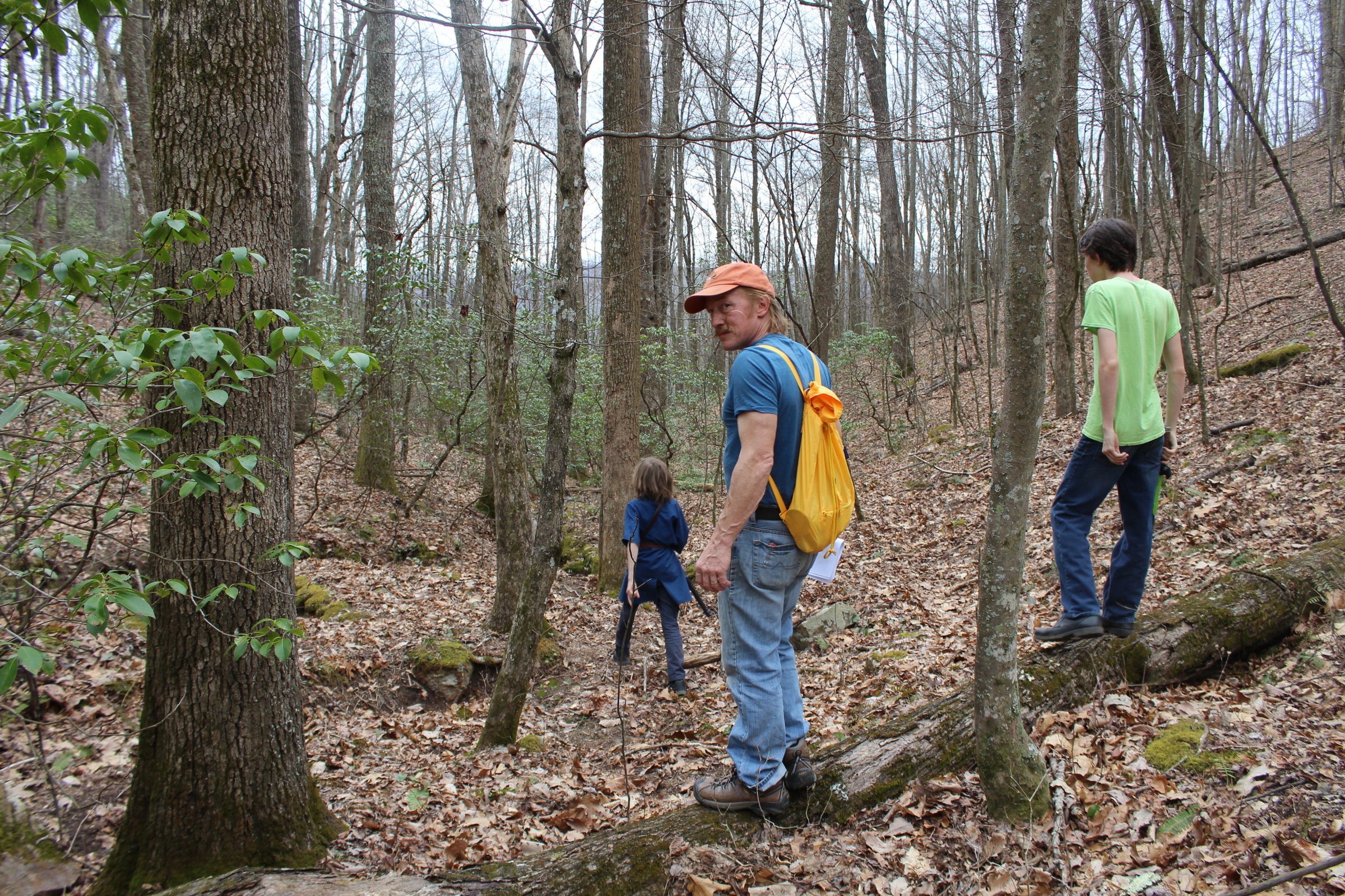
We were back on Clinch Mountain the next day after lunch. We parked under the power-line and hiked up the mountain clutching our treasure map plats. Halfway up we found traces of two more cabins where the old road was. We were on the 15 acre plot, and it was lovely with great rocks jutting out of the hillside. We crested the ridge and took in a fantastic view. I reasoned that the back line of the property connected three peaks. The smallest in the 15 acres. We followed the ridge up into the 31 acres. At the middle peak we were greeted by some monster trees 24 inches in diameter. Everyone had a different idea of what could be built on this level area with a view in all directions. A studio. A meditation chamber. A forge. A tree-house. With every step we were falling more in love.

IMG_1694.JPG

Between this peak and the next was the ravine, a long, steep way down. I picked my way down as straight a line as possible, while the boys sword fought all over the hillside and Bethany chose a gentler path to meet me at the bottom. And there it was. WATER! There was a hundred yards of stream gurgling before vanishing underground. We stared, enraptured. “This could just be run off from the rain.” Douglas pragmatized.

IMG_1735.JPG

“It might not even be on the property.” Bethany allowed.

IMG_1727.JPG

“Well,” I reasoned, “if I came down from There, and That peak is There...” I walked 10 paces to where the stream emerged, “The property line should be about... What's that?” I was pointing at a hole in the ground ringed with stone, a few dead logs fallen across. We gathered around. It was a well of sorts, built down three feet into the ground out of mountain rocks covered in moss, the stream bubbling away at the bottom. It looked ancient. Mystic. What must have been a tin cover lay rusted nearly to nothing at the side. “I don't think it's run off.” I said quietly, feeling like we'd just found gold.

IMG_20180319_162104.jpg

The property went up to the next peak then cut parallel with the ravine to 66. It was the steepest bit of land and covered with the only underbrush we'd seen so far. We chose to follow the stream-bed till we found the old road, taking it back toward the 15 acre plot.

IMG_1729.JPG

I walked close to Bethany, no longer focused on the forest but on the feeling of certainty the enchanting stone well had produced. I looked sidelong at her. “This is it, isn't it?”

“Yeah!” she whispered, just as sure. Our lids welled with tears. Tears of certainty. Tears of admitting it. Tears of hope breaking the seal. We walked, fingers entwined, another 30 steps. “Let's tell the boys.” I said.

The boys were of course on board. We formed a circle of four on some stones and in formal tones asked God for this land we couldn't afford for our own. The boys once more warred with their swords on the road. We followed it back, crossing the power-line into the 15 acre plot to a junk heap at the foot of the smallest peak. It began to rain softly. Happy, we made our way down to 66 and Matilda.

IMG_1769.JPG

We shut the doors and sat awhile. Having settled on this land in our minds, the pressure to start creating had already doubled. Over 10 years ago in Brooklyn, swamped in debt, we cut up all our credit cards with scissors, resolving never to go into debt again, never to purchase anything we didn't have the money for. We've stuck with that and been much lighter for it. But now this immense desire was threatening to shred our resolve. “But even if we tried to take out a loan,” Bethany was saying, “Our lack of ANY credit history and having no steady income would make it impossible.” I turned on the wipers and put it in gear.

“There has GOT to be a way.” I said, pulling out.

We stopped in Sneedville for groceries. Bethany went in the store and I called Kenny. “We want it.” I said, “but we want to pay cash. I don't want to take out a loan. I have an avenue I want to pursue.” Thinking of something like Kickstarter.
“Well, Ah haven't asked, but I bet these guys would be willing to do Owner Financing if you could put 25% down,” he said helpfully, making my no-loan-walls bulge like soup in a paper-bag.
“Thanks,” I said “I'll consider that.”

IMG_1574.JPG

At the campsite that night it hit me. One of the biggest lessons we've learned at the end of our rope on this journey has been – DO WHAT IS IN FRONT OF YOU. Before having my heart pounced on by this land, I was on my way to Knoxville to make art to raise money. Nothing had changed. Nothing other than the incentive becoming a tangible piece of perfect land that might be snatched up at any moment. So I'm putting down this pencil and picking up a paintbrush. My theme will be taken from the 60,000 photos of our journey. It is time to paint wind! You may expect a billowing sale shortly. And if this land slips through our fingers... so be it. We will still be free, still taking the next step onward, but we'll likely need new latches on our lid, and a deck-swab to mop our tears.

IMG_1774.JPG

A final note before I paint – After getting back to Knoxville we looked up Kenny's online listing and found the plot we had explored was only HALF the 31 acres. That would be equal parts Icing and Cake.

subscribe via RSS or e-mail

> archive of older posts here <

Trying to Keep a Lid On It / Part 1

michael

This is a two-part series, and both parts include an audio version of Michael reading it ... in case you'd rather just listen! 


Yeah. We've been hunting for land. Scouring websites, deciphering contour maps, printing out plats, and zooming in on satellite imagery. This began in earnest around the New Year. A month ago we left Keren + Bobby's driveway in Knoxville, where we'd roosted since December 9th, and parked at a small campground in the foothills of the Smokies, near Greenville, TN. This would be our base camp.

After two excursions to see plots we'd found online, we came to some conclusions. Firstly, property in our current budget was: A. landlocked and only accessible by helicopter or walking through Posted No Trespassing signs; B. so steep you expected a princess on top to throw golden apples to anyone who could climb that high; or C. ugly and flat as opossum roadkill, skinny as the blighted mange.

IMG_1433.JPG

We secondly concluded our favorite part and best avenue by far was talking to the denizens. The people we'd met were open, honest and friendly. Happy to elaborate on who owned what and how many tractors were traded to make the purchase. All without squinted suspicion (my mustache makes a good barometer of judgmental character.) Our third conclusion was we might as well relax and just look for neighborhoods and hollers that appealed to us. It was no good vexing our souls, drooling over property beyond our means. If God was going to lead us to some land like we'd asked, He was going to do it in His own sweet time. And anyway, He'd probably be interested in seeing what we liked.

IMG_1094.JPG

So we began exploring every mountain road in the Greenville area, with a much easier agenda of finding enjoyment unhampered by expectation. It was beautiful. The shapes of the Smokies sang to us. The mossy streams danced and burbled beside us down winding roads. Ancient, sagging barns waved their cockeyed doors and blooming pear trees traced the hills like lollipops.

MVIMG_20180306_164253.jpg

On days it rained we distracted ourselves by organizing and pruning the 60,000 photos taken over the last three years, talking about the changes our life has taken and will take, and getting the taxes done. (I think that's the first time we haven't filed late since we were married.)

MVIMG_20180306_165546.jpg

Being patient isn't easy. For over a year an immense pressure has been building to settle down and start creating something we won't have to walk away from. A physical place to plant the dream and see what grows.

IMG_1438.JPG

After three weeks and four days there were no more roads to explore within striking distance. It was time to move on. The plan was to explore at least one more area on our way back to Knoxville, where I would immerse myself in creating a body of artwork to sell to raise money for something more than the back nine of a junkyard by a power plant. Sounds crazy, by hey, it's how we paid for the camper. We battened down, hitched up, and piled in the truck. Matilda purred. This has been the heart of the trip to me. This point. All in the truck. Asking the question. “Well … where to now?” Bethany has the map in her lap and there's a sense we might just go ANYWHERE.

“What about these mountains?” She's pointing to some smaller ranges we had previously discarded, but now we had sense that beauty was not contingent on size.
“It'd be a shame not to at least drive through them” I mused. Her finger went to a dot.
“Wasn't there an abandoned school listed near Sneedville?”
“SNEEDville!” I bellowed, loving it's Seussian sound. “Let's Go!” and off we went with the boys and I chanting “Sneedville, Sneedville, Sneeeedville!” to the rolling of Bethany's eyes.

IMG_1543.JPG

We took the scenic route. The closer we got to Sneedville the prettier it became. Pioneer-looking log cabins were frequent. Rock-jagged green hills strewn with cattle. A proliferation of ancient barns staggered the hills, in every stage of collapse, as if this was where old barns came to die. We got on Route 66 and were delighted to discover we were heading over Clinch mountain. Near the start of our journey three years ago, our bedtime-story had been a Louis L'Amour book about the pioneering Sacketts who had settled Clinch Mountain. Now we would see it! Nearing the crest we saw a For Sale sign and slowed down.

MVIMG_20180319_151949.jpg

“That looks level enough to build on!” Bethany said, amazed.
“And it's South-facing!” I added, wishing Tennessee roads had more than one inch of berm so I could stop.
“Oh, here's a power line,” we both said as we approached a great swath cut up the mountain.
“Yeah, but look at the view!” I breathed, looking down to the valley.
“Here's another For Sale sign,” Bethany pointed. “It's a different realtor.” The land behind that sign was equally promising.
“We have to come back here without the camper” I said, not running off the road.
“Let's find a campsite” she said as we crossed from Hawkins into Hancock County. Cell service was spotty descending Clinch, but we were only 12 miles from Sneedville.

In those 12 miles of gorgeous winding road we noticed something: every car we passed, every person in their yard, on their porch, in their doorway – EVERYone waved. Now I grew up on a dirt road in PA where five out of 10 people waved, and two of them might wave to total strangers but I had never seen this. Big waves. Smiling waves. “Hi! How y'all doin! Ah still got mah hand in the air” kind of waves. I was driving along stunned happy.
“You missed it!” Bethany chortled as a pickup passed, “That guy just waved.”

IMG_1559.JPG

Once we hit Sneedville the waving stopped. We found a pullout at a crossroads and began Googling campgrounds. Nothing. There were no campgrounds in Hancock county. The closest one was 30 miles north in Pennington, Virginia. Bethany called and got a precise-sounding man who said he had room, but neither of us wanted to go that far away from Clinch Mountain. A sign in front of us read 'Kyle's Ford Trading Post – 10 miles.' “I bet they'd know a place to camp” I said.

We passed about six people in those 10 miles. One of them didn't wave but he was facing away from us putting what looked like an air conditioner in his trunk. The folks at the Trading Post didn't know of any camping. “Summertime you could go down on the Clinch River but that's been a soggy mess since the flood a few weeks back. Hang on, here comes Betty. She'd know, she's the Vet.” Betty came in and put a bag of something heavy on the back counter.
“No.” She shook her head when asked. “Not in Hancock County.” We drove on.

IMG_1563.JPG

It was about 4 pm. We were just deciding to catch Route 70 a mile ahead and take it to Pennington when we passed an abandoned school. “Whoaaah! Look at that!” we all gasped. It was vandalized, but pretty alluring. More so than the one we'd seen online.

IMG_1799.JPG

“We could stay in the school yard,” I suggested as we came to a T in the road. I pulled off into the gravel at the stop sign trying to judge if I had room to turn around. “Worst they could do is kick us out!” Bethany was half-convinced, still looking at Route 70 on her map. A pickup truck pulled up beside, its passenger window going down. I rolled down mine.

“You folks need help? Whatcha lookin for?” A face about my age was beaming hopefully.
“We're lookin' for a place to camp!” I shouted back. That was all he needed. He was out his door like a shot and around to my window.
“Camping you say? Hmmmmm … Ah can't think of a place – ”
“What about that abandoned school back there?” I interjected. “Is that owned by somebody?”
“That's owned by the County. Yeah! You could stay there! But wait a minute ...” My willingness to stay anywhere had got his mind rolling. “There's the boat launch! That's public access land. Right down over here, by the river. Ahm sure your camper'd fit there!”
“Sounds great!"
“C'mon. Ah'll show you the way!”

He hopped in his truck pleased as punch to be helping someone, and was a quarter mile up the road waiting for me by the time I got pulled around the corner. It was a perfect, well-graveled spot by the river. I got his name. Tommy Belcher. We shook hands and he popped back in his truck and zipped over the hill.

MVIMG_20180316_185451.jpg

The boys unhitched and stabilized the camper. The cats were let out to roam the fields of dried sunflowers. Bethany and I got out the chairs and watched the Clinch River calmly saunter through the velvet sunset at Kyle's Ford. “Soo...” I said, trying not to sound too excited. “I guess we'll go look at that land in the mornin'?” Bethany remained deadpan, staring at the river.
“Yuup” she drawled. We looked at each other, eyebrows raised a few moments, then burst out laughing.
“Thank God for Tommy!” I shouted. Bethany was wiping tears from her eyes.
“I did NOT want to go to Pennington,” she giggled.


Next morning we charted a course that would take 70 over Clinch mountain to Poor Valley Rd heading West along the South face for 10 miles to 66 where we'd again cross Clinch and find that property. We packed chicken salad, snacks, water, and hiking boots and off we went. As 70 crossed Clinch we saw a For Sale sign and stopped to take a look. The area was very pretty. Not as nice as our destination, but worth a gander. There was a gate with a grassy road going up the mountain, but the sign didn't say how many acres. Seeing no neighbors I could ask, I gave the number a call. Cynthia answered. It was 287 acres. I told her that was way too many. I was looking in the realm of 15- 20. She said her husband Kenny ran a different real-estate business that sold land, she mainly sold houses, but she'd let him know. He was out listing some property right now an– The phone cut out. I was relieved. I hadn't wanted to tangle with agents yet, and was kicking myself for going that far. We drove on.

IMG_1606.JPG

Poor Valley Road was a disappointment. The houses were too close together and no roads left the valley to climb the South face of Clinch. None that is, till we got to the end and saw a gated road with 109 acres for sale. We went and asked the lady who'd waved from a trailer we'd passed if it'd be all right to walk up that road. “People do it all the tahm,” she said. Then she told us her family history. Bethany and I left the kids reading books in the truck and climbed the wide, steep road till the view and the hike became so breathtaking there was no need to go to the top. The road alone was probably triple what we could afford. Back at the truck, I found Cynthia had left a message about the land her husband just listed, and it was off New Life road, 10 miles from us. We looked at the map. New Life road was less than a mile away across Rt 66.

IMG_1636.JPG

I had just put Matilda in gear, when my sister Keren called. She had been expecting us to land back in Knoxville on the morrow and wondered if we could delay our return by 2 or 3 days – she and Bobby had some things they wanted to finish up. “Sure!” we said looking at each other, thinking of our riverside paradise. Off we went to New Life.

IMG_1641.JPG

We found some signs for a 25 acre farm in the valley that held little to no appeal. Relieved, we started up the mountain on 66 to our destination. It was right there where we left it. A small road we hadn't noticed on our first pass through cut up the hill about 30 feet. It had a chain across that left just enough room to back Matilda off the road. We donned our gear and tumbled out. My phone rang. “Oh.” I said, “It's Cynthia. I'll answer it and tell her we saw that farm and aren't interested.”

“No,” Cynthia said when I told her, “it's not a farm. The property's all forested, and it's not on New Life Road. Here, talk to Kenny.” She handed him the phone. Kenny talked a blue streak describing where it was until finally I said, “Well, that's exactly where I'm standing! That's the property I'm looking at right now!” We talked a good 25 minutes.

IMG_1654.JPG

Turns out the driveway had been put in the day before by the owner who runs a construction business. The plot was 31 acres for $55,000. The neighboring plot for sale by a different realtor was 15 acres for $30,000. The remains of a cabin could be found 150' in. When Kenny was Commissioner of Agriculture and Forestry for Tennessee he had the boat launch installed where our camper was parked. Yes, he knew Tommy Belcher. Junior and Senior. Tommy Sr. was 70 just like Kenny. No, they couldn't email the plats till they got back home in two to three hours. Yes, they'd be willing to meet up the next day to show it to us.

I got off the phone a little dazed. We couldn't afford this! Not even the 15 acre plot. Why was I setting up a meeting with a realtor?!

IMG_1714.JPG

As we tramped the gentle slopes of perfectly sized building stones and tall straight timbers, I tried to explain to Bethany what went through my mind talking to Kenny. “If Keren hadn't called in the one spot we had cell service in the valley and asked us to stay longer, and if Tommy hadn't stopped and showed us that perfect camping spot by the river, and if Kenny hadn't known Tommy or been so congenial, plus he knows forestry and building codes for the county, and if everyone in the county hadn't waved at us... we did say it's about the people, right?”

“I know.” Bethany whispered; a spark of hope dancing in her eye like a moth on fire.

IMG_1703.JPG

We found the flattened cabin. A Coke can in the rubble looked from about 1970. The trees seemed not to have been lumbered for as long. The slope got steeper approaching the peak but not so steep it couldn't be built on. We didn't walk to the peak. We didn't walk to the ravine that might have a stream. We didn't know the boundaries and we didn't want to get our hopes squashed. The boys were breaking down with hunger so we drove back to the river to have supper with songbirds and peepers. We agreed the land was twice as good as we expected.

MVIMG_20180316_182336.jpg

... the story continues in Part 2

subscribe via RSS or e-mail

> archive of older posts here <

The Boyds

fynn

After Aran and Lexie's wedding, the Boyds said we could park at their house.  When we got there, we parked in the cul-de-sac and got unhitched. We went inside and met Bordeax the dog, and talked. 

Two or three days later, Stan offered to take us water skiing. So we went.  

We had to pull the boat out of storage so we took off the tarp and towed it to the launch. We launched and Lois was there but she had some appointment so she could only be there for part of the time. So we went on the Delta.  At first it was slow because there was a lot of parked boats. 

When we got out of the slow zone we went for awhile.  Then Stan showed us how to ski and did a test run. 

Douglas went next, he got up for about one second. 

After Douglas went, we took Lois back and dropped her off.  Then we went back out. I went next but the skis didn't fit so I kneeboarded.  I lasted for about a minute. 

IMG_5325.JPG

I think Mom went next. I don't think she could get up so she kneeboarded.  My dad got up for about 3 minutes ...

... then I went again on the kneeboard.  I was able to stay up for about 5 minutes, until there was some sort of waterfall and it made waves and I was getting pulled into it. 

We went around a bit and looked at some houses, and started to go back. When we got back we went and towed the boat back and put the tarp back on and went back to their house.  

The next day we went to Aran and Lexie's.  When we got there we talked awhile until me and Douglas went to the park across the street. After we came back we went to sleep on the floor.  The next morning we got up.  Aran went to work and we all walked to the park.  Me and Douglas played awhile while the grownups talked.  When we got to the apartment it was time to go. 

We got back to Stan's house.  He offered to take us flying that day.  We went to the airport and Stan drove us there.  We had to wait for the plane.  Stan checked the plane. 

Everything was good.  So we waited for the runway to be clear and Stan put it into full throttle and we took off. 

We flew for awhile until we got out of range of the airport and Stan said I could fly the plane and showed me how the controls worked. 

IMG_5765.JPG

After that we flew over the Golden Gate Bridge. 

Not long after that we started heading back. Stan did a partial dive but we couldn't do the death drop of zero gravity because my mom got sick.  

The next morning we left. 

subscribe via RSS or e-mail

> archive of older posts here <

Westward Ho! / Wrapping it all up ...

bethany

Twelve days from Indiana to San Fran, intense and packed and sometimes heart-wrenching days. Emotional ones at the very least. So much to process, so much to see … life to live, relationships to work on, kids to grow, feelings to feel.

It's funny how, from the outside, it sometimes looks like we're on a multi-year vacation. Yes there is freedom to this life, huge amounts of it, but there are many many balances to it too. Large amounts of insecurity, if you're hoping to know what's next and how your daily needs are going to be met. Great stretches of loneliness, and disconnectedness, punctuated by intense interactions and deep conversations. Bouts of hard work, followed by dearths of any known opportunities to jump in and help.

I've been reading a Louis L'Amour book to the boys for bedtime story recently, and there's a line in it that really struck me. The main character (Echo, a spitfire crack shot 16-year-old-girl outrunning some would-be thieves, of course) was planning to hitch a ride with some settlers going west in a wagon, and the boarding house owner she'd been staying with disparagingly referred to those headed west as “Movers.”

Her response …

“We were all movers at one time, Mrs O'Brien” I said. “Even you when you left Ireland.”
“I suppose so, but somehow it seems different.”
“Settled folks always look down upon the unsettled,” I said, “but somebody has to open the new lands. When they are settled in their homes, they will feel just as you do.”

We're not doing anything new, but we're doing something Other. And I often feel the Otherness of it, keenly, even though the comments made and the sentiments felt by others are not disparaging, but wistful or a bit jealous or just plain encouraging. There's often the feeling of a complete disconnect … this isn't fathomable or understandable. Or perhaps just romanticized in the same way that I intently identified with Laura Ingalls standing and watching the long lines of braves and families wending past her house on the edge of the prairie as they left a council of war … wishing she were a wee one tucked in one of those saddle bags. I so wanted the very same thing, and I think I've gotten it as much as is possible in the year 2016.

There's some Mover in most of us … that bit (tiny or huge) that wants Other, and seeks out new experiences and places. Whether it comes in armchair galloping with Louis L'Amour, Netflix soaring over some new continent, trips of a lifetime that span the globe and inspire FaceBook envy, or choosing to live for decades as an RV gypsy … we get that itch, and we do our best to scratch it however we can.

I'm afraid I've rather systematically tried to debunk the notion that this is a relaxing vacation, or anything other than Life, made mobile for now. I keep bringing up the downsides, the struggles, the hard bits, and don't tend to sing the praises as loudly as I could be. I'm interested in keeping it real, and I think I've always been more fascinated with the messy bits than the pretty bits. Life, and relationships especially, are inherently messy and anything that seems to focus too much on the happy/solved/perfect parts is highly suspect to me. We're all broken, all imperfect, all unfinished.

I find something innately invigorating in the messy stuff, and while it may hurt like mad … it's a chance to change, to grow, to see things differently, and to maybe find a new viewing point. Asking what possible good can come from it, even if it's painful? There's always some answer.

I'm also a huge believer in community, fellowship, and sharing the load when we can. Chasing the joy to be found in connecting, in being seen, and in sharing whatever is to be shared, heavy or light. The joy at the end of this trip was palpable and filling. We shared in Aran and Lexie's joy, and it fed my tired spirit in a way that brought balance to the personal relationship work that kind of dogged the last half of the trip, evening up the keel for awhile. It was delicious. We've had many chances to share sorrow and hurt too, and it's always an honor. Being trusted with someone's pain isn't easy, but it's still a real connection. It's a window I try to never close, so help me God.

I said I was wrapping it all up, and I seem to be wandering in all directions. I've written and erased about 5 different endings actually, and none seem to do the job. I started out writing a travelog and ended up getting personal again … had to balance out all those pretty pictures, right?

So … it was messy, it was beautiful, it was worth every minute.

Onward ...


previous posts : DAY 1  / DAY 2 / DAY 3 / DAY 4 / DAY 5 / DAY 6 / DAY 7 / DAY 8 / DAY 9 / DAY 10 / DAY 11 / DAY 12 / Wedding Weekend

subscribe via RSS or e-mail

> archive of older posts here <

Westward Ho! / Day 9 ... Drama King Drama Queen

bethany

Tuesday, August 23

Escalante sunrise

Escalante sunrise

Recovering from yesterday took a couple of hours – groceries to track down, photos to download, emails to send – and we took off again around noon. Our first real stop was a pullout that offered a short hike to a mossy cave and a waterfall.

Red cliffs, a stream, and a few small stone arches added to the appeal. The stream was fed by a 2-mile long canal that had been hand dug in the rock in the 1860s by some settlers trying to get water into their otherwise perfect valley. We enjoyed the view, the boys got to run around, and we kept an eye on some gathering dark clouds.

Michael Instagrammed a pic of the boys and I with the red cliffs and lowering sky, tagging it “ominous clouds”, and then we went on down the road to the Bryce Canyon Visitor's Center.

Just as we pulled up to the fee booth, the clouds broke and it started hailing with a vengeance. Michael flashed our National Parks pass under the agent's nose, wincing and getting pelted, and then grabbed the park map and RV Restrictions notice that was shoved at him with a mirroring wince. Windows were rolled up, bounced 1/4” hail collected, and we sloshed to a corner of the parking lot to wait it out with everyone else.

Ten minutes later it subsided into rain, and Fynn and I dashed into the Visitor's Center to retrieve a better map and some more info on turnaround spots, pushing past steaming wet crowds of fellow tourists who were trying to take selfies with the shoveled pile of hail right outside the front doors.

Bryce has one 18-mile road that's an out-and-back deal, with a side loop that's off limits to rigs our size. We did most of the pullouts, shivering and damp, but loving the deep oranges and hoodoos and rainbow rocks.

At the end-of-the-road stop there were two viewing spots, one being a short hike down the promontory from the parking lot, and we remarked on the path to it on the way to the nearer one. We took in the view, increasingly cold, and Michael agreed to start his sciatica-hobble towards the second viewpoint, while I went with the boys to the bathroom and then caught up with him.

The crowds were getting to me, as was the cold/wet thing, and we were all getting tired. A fearless raven distracted me while waiting for the boys, and then we set off down the ¼ mile path, expecting to see Michael at every turn.

Got to the end, lovely view, no Michael.

We tossed a few pebbles over the edge to see how long a drop it was, took a few pics, and headed back … maybe he'd decided to go to the restroom too? Turned back due to pain?

Checked the restrooms. Checked the first lookout again. Checked the shelter.

Muttered, grumbled, shivered.

Looked into the truck and camper, but both were still locked, and Michael had the keys.

Muttered some more, and got a wee bit uneasy. Where could he possibly have gone?

A man with two kids saw us wandering, and must have seen us together with Michael earlier, as he pointed along the edge of the tree-lined cliff, and said “He's down there!”

“How far?” I asked.

“50 yards or so …” was his answer.

Off we went, tramping noisily down the sorta-path along the edge … no Michael. Then Douglas spies his hat … the ever-present-felt-fedora-ish thing he wears … perched neatly just a couple feet from the dropoff. He picked it up.

“Well, here's Dad's hat …” he offers, his tone bemused, with a dash of hesitation.

I look at it, and the spot where he'd found it, run an instantaneous Michael-over-the-cliff scenario in my head, which about 2% of me thinks is possible … and I've just gotten to the part where my brain says “but if he'd gone over in the 90 seconds since that man told you he'd seen him we'd definitely have heard it” … when he pops up from behind a bush 15 feet down the path, and cheerfully says “Here I am!”

I stare at him … ready to punch him and then maybe toss him over the cliff. Really?!

He'd spent 25+ minutes waiting for us, on the wrong path (at least not the paved path that said it went to the viewing point, which I'd commented on earlier) … assuming that we'd been delayed at the bathroom, and concocting what he thought was a funny prank to play on us. The fact that we'd already been hunting rather urgently for him for 15 minutes already rather took the last shred of potential humor out of it for me. Ha ha.

It was a rather chilly ride on the 18 miles back to the entrance, despite the truck's heater.

Predictably, Fynn needed to pee as soon as we left the park. We stopped at the tackiest souvenir shop yet seen, begged the bathroom key from the dour and very shop-worn proprietress, and after failing at small talk with the woman I tried to be interested in dusty shot glasses, bad wood carvings, and made-in-China-we-don't-even-pretend-to-be-authentic treasures while Michael and Fynn disappeared around the back. When Fynn returned, he bought himself a bandana before we all scooted out the door just as another carload came in asking for the key. I heard her voice drop another level as she eked out her answer.

Relieved to be back outside in the bit of remaining sun, we headed to the truck … only to discover that Michael had left the keys in it, and someone's elbow must have bumped the lock button on the way out.

It wasn't a happy moment. I let Michael tackle it, still smarting a bit from the hat incident, and yes, sulking. I joined the fray when it was suggested we try to break into the trailer to get a coat hanger, and helped force a window open to boost Fynn in through the slit. After the hanger was bent and I watched him try to press the unlock button with it, I realized that maybe the back window of the truck would be easier to get into as it had no electric lock. A screwdriver twist later, we were in!

Light fading, we made for another patch of Dixie National Forest on Rt 12, assuming we could find a boondock spot. We did come across one pretty quickly, though the access to the site was a bit rutted and dicey … and we'll just gloss over the fact that there was the decision to unlock the bikes and go rambling off on the back roads to see if there was a better site back in there somewhere … before bumping our way to a nice level spot with a turnaround, and plenty of dead wood for a campfire. Whew. Very glad to finally be at rest!

Things seemed a bit brighter by the next morning :)

Things seemed a bit brighter by the next morning :)

lots more pics here and here

previous posts : DAY 1  / DAY 2 / DAY 3 / DAY 4 / DAY 5 / DAY 6 / DAY 7 / DAY 8

subscribe via RSS or e-mail

> archive of older posts here <

Westward Ho! / Day 8 ... Utah ... Wow!

bethany

Monday, August 22

Matilda in hiding ...

Matilda in hiding ...

Up early, atlas consulted, and decision reached – we'd cut southwest across Utah, and try to hit three national parks in two days; Canyon Reef, Bryce Canyon, and Zion. A brief stop at the Utah Welcome Center modified that slightly, as the very friendly and knowledgeable fellow behind the counter warned me that there were height restrictions between Bryce and Zion that would be too low for us … we're around 12.5' high with our air conditioner. Glad to find out in advance!

We cut off of I70 onto 39 South, and the fun started. The terrain changed constantly … and suddenly. You'd go up over a rise and come out into a whole new planet.

Much of it felt like Mars, for the redness and the nearly inexplicable formations, but it was as delightful as it was disorienting. Cloudy, a bit of rain, and nicely cool.

We hit Canyon Reef first … which was really nice as you drive through the canyons and rocks, rather than peering at them from an overlook. It felt personal and accessible.

Navajo Dome, Capitol Reef NP

Navajo Dome, Capitol Reef NP

We stopped at many pullouts, listened to a ranger talk about the petroglyphs left by the Fremont Indian culture, picked free apples in orchards left by a former Mormon outpost called Fruita, and then took off towards Bryce in the late and rainy afternoon, heading south on Rt 12.

The Rand McNally Atlas has no elevation markings on the state pages, other than the occasional peak height. It's my main form of navigation, as Google is often not available, and I prefer paper in my hands and the “big picture” anyway. So my assumption that the upcoming Dixie National Forest was rather flat was a somewhat misguided one.

We climbed up over the 9600' peak of Boulder Mountain while passing through, and saw a number of boondockers and some cattle dotting the rolling meadows at the top. So tempted to join them (despite the cold!), but we went on, though not without leaving our windows down so we could continue to enjoy the divine smell of wet sagebrush … yum!

One overlook near the top, half lit with the last of the sun, had a view of Mt Ellen's 11,500' peak, and the “biggest” vista I can ever remember seeing. Layers upon layers of buttes and trees and mountains and colors and light. Utterly magical. According to the placard there, we were looking at the last bit of the lower 48 states to get mapped, which happened sometime in the 1850s.

Then down the mountain in the gathering gloom, including a couple spots of 14% grade, heading into the large empty-looking blob on my map labeled as the Grand Staircase Escalante National Monument. About which I knew exactly nothing. So why we were shocked to come down off the mountain and find ourselves on a wet, winding, very narrow road between two deep canyons, I'm not too sure. It was par for the course.

It was visual overload for all of us, but insanely wild and empty and beautiful, though increasingly hard to see. We wound, swooped, curved, teetered (or so it seemed) through the trackless wild, seeing only a couple other vehicles. The only sign of habitation in the next hour was a coffee shop(!) perched out on a promontory over a canyon, but it sadly had closed at 4pm. I don't think we would have fit in their parking lot anyhow.

We climbed our way slowly up and out of the canyons, headed for the next dot on the map that implied people and services, labeled Escalante. The last overlook offered the story of mule trains delivering mail there, in winter at least, as recently as 1942. It wasn't hard to imagine at all.

The road we'd just traveled ...

The road we'd just traveled ...

Matilda purred her way into town (that filter wash made a big difference!) and we found a pricey-but-we'll-take-it RV park that had a laundromat, WiFi, and a paved pull-through … perfect! My journal entry for the day ends with “exhausted and exhilarated”, and that pretty much sums it up. It was an astoundingly full day of strange and beautiful sights, and the fact that it was all surprising made it even more enjoyable.  Lack of research meant that the expectations were pretty low, and we gobbled up the beauty we stumbled across without having any regrets over things we missed. 

see Flickr for lots more pics for Utah! and Capitol Reef and Grand Staircase Escalante

previous posts : DAY 1  / DAY 2 / DAY 3 / DAY 4 / DAY 5 / DAY 6 / DAY 7

subscribe via RSS or e-mail

> archive of older posts here <

Westward Ho! / Day 5 ... Crossing into Colorado

bethany

Friday, August 19

Our neighbors pulled out long before we did, but after giving Matilda's engine a once-over and tweaking the fan shroud, we made a quick jaunt into town to get groceries, and check out the Pony Express Station/Museum that had been relocated into the local park. After gathering tidbits like the fact that the service only operated for 18 months, riders were preferred to be teenage orphans, and that the fastest trip over the whole 1840 miles was 7 days and 17 hours and carried Lincoln's inaugural address … we scurried back to the camper, hitched up, and headed west towards I70. We had debated the whole I70 vs I80 thing, but opted for the hillier and more scenic southern route.

Our late start meant that we decided not to push through Denver that day, but took our time. At one of the big truck stops, we finally got our rig weighed, something we'd never yet dared to do. We knew the empty weight of Matilda was 6300 lbs, and the empty trailer was 5400 lbs, but I'd long suspected that we were a fair bit over our GVRW load limit given that we've got a lot of tools and books in every nook and cranny. We can add about 2200 lbs of stuff, but that includes any water and propane in the tanks, not to mention all our personal belongings. It adds up fast!

After asking at the trucker's counter how the whole system worked (and being a bit sheepish about it, just because camper folks aren't always welcomed with open arms there), I paid for the required access code and got back in the truck. We swung through the scales, picked up our results, and discovered that we were just under our overall limit! Phew. Nice to know before heading over the Rockies :).

IMG_1716.jpg

Crossing into Colorado was a bit weird … the scenery changed almost immediately to scrubby hills full of cattle, and corn fields. The views were a lot longer, and it just felt different.

IMG_1826.JPG

We found a free city park “campground” in Fort Morgan that included 15amp electric, which turned out to be a parking lot with a small median strip that had some outlets 6' up on the streetlight poles. We jury rigged our cord to one of them so that the weight of the extension cord wouldn't yank it out in the night, and I started in on dinner. Our neighbors, with the exception of one spiffy looking 5th wheel, all seemed to be living out of their cars or trailers, and not by choice. It became the Friday night drag strip for awhile, but quieted down early enough to get some really good sleep.

previous posts : DAY 1  / DAY 2 / DAY 3 / DAY 4

subscribe via RSS or e-mail

> archive of older posts here <