Westward Ho! / Day 8 ... Utah ... Wow!
bethany
Monday, August 22

Matilda in hiding ...
Up early, atlas consulted, and decision reached – we'd cut southwest across Utah, and try to hit three national parks in two days; Canyon Reef, Bryce Canyon, and Zion. A brief stop at the Utah Welcome Center modified that slightly, as the very friendly and knowledgeable fellow behind the counter warned me that there were height restrictions between Bryce and Zion that would be too low for us … we're around 12.5' high with our air conditioner. Glad to find out in advance!

We cut off of I70 onto 39 South, and the fun started. The terrain changed constantly … and suddenly. You'd go up over a rise and come out into a whole new planet.
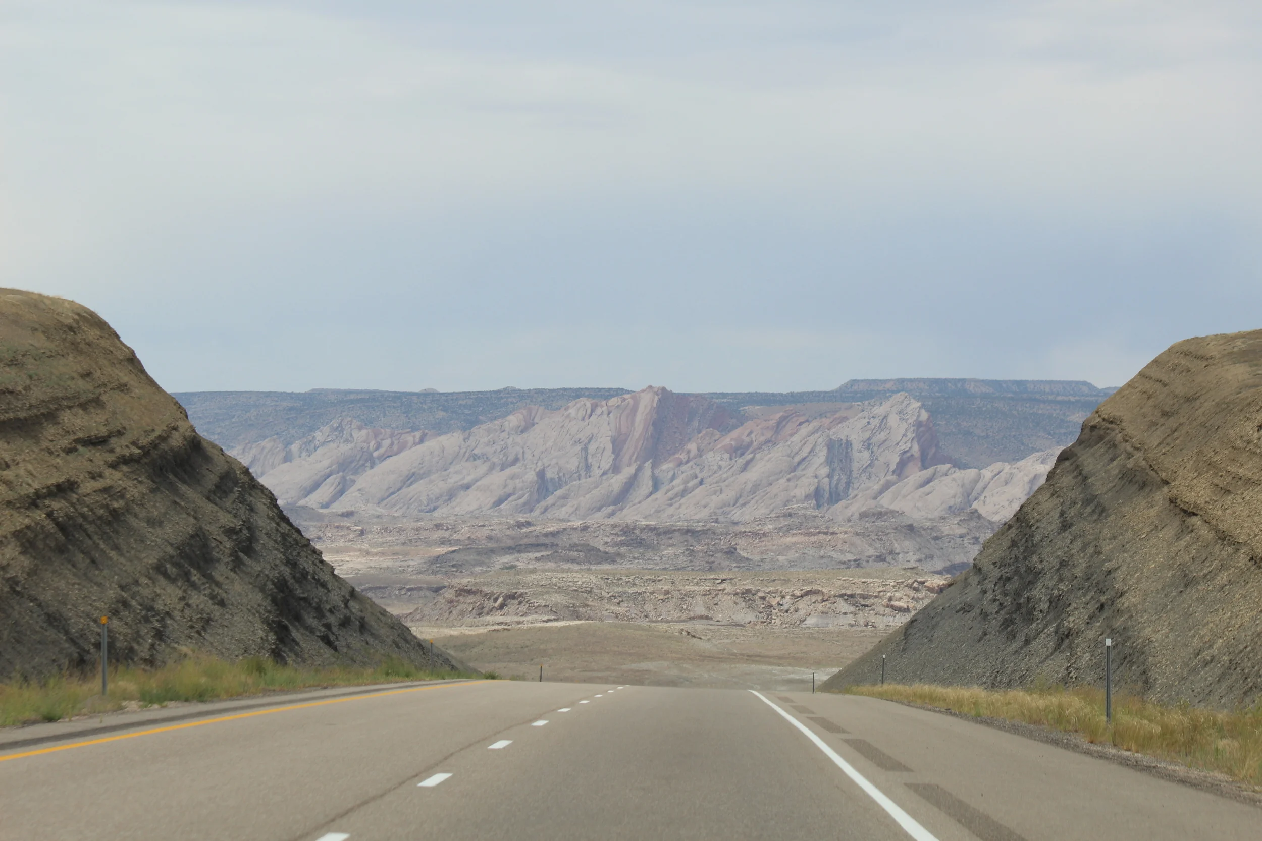
Much of it felt like Mars, for the redness and the nearly inexplicable formations, but it was as delightful as it was disorienting. Cloudy, a bit of rain, and nicely cool.

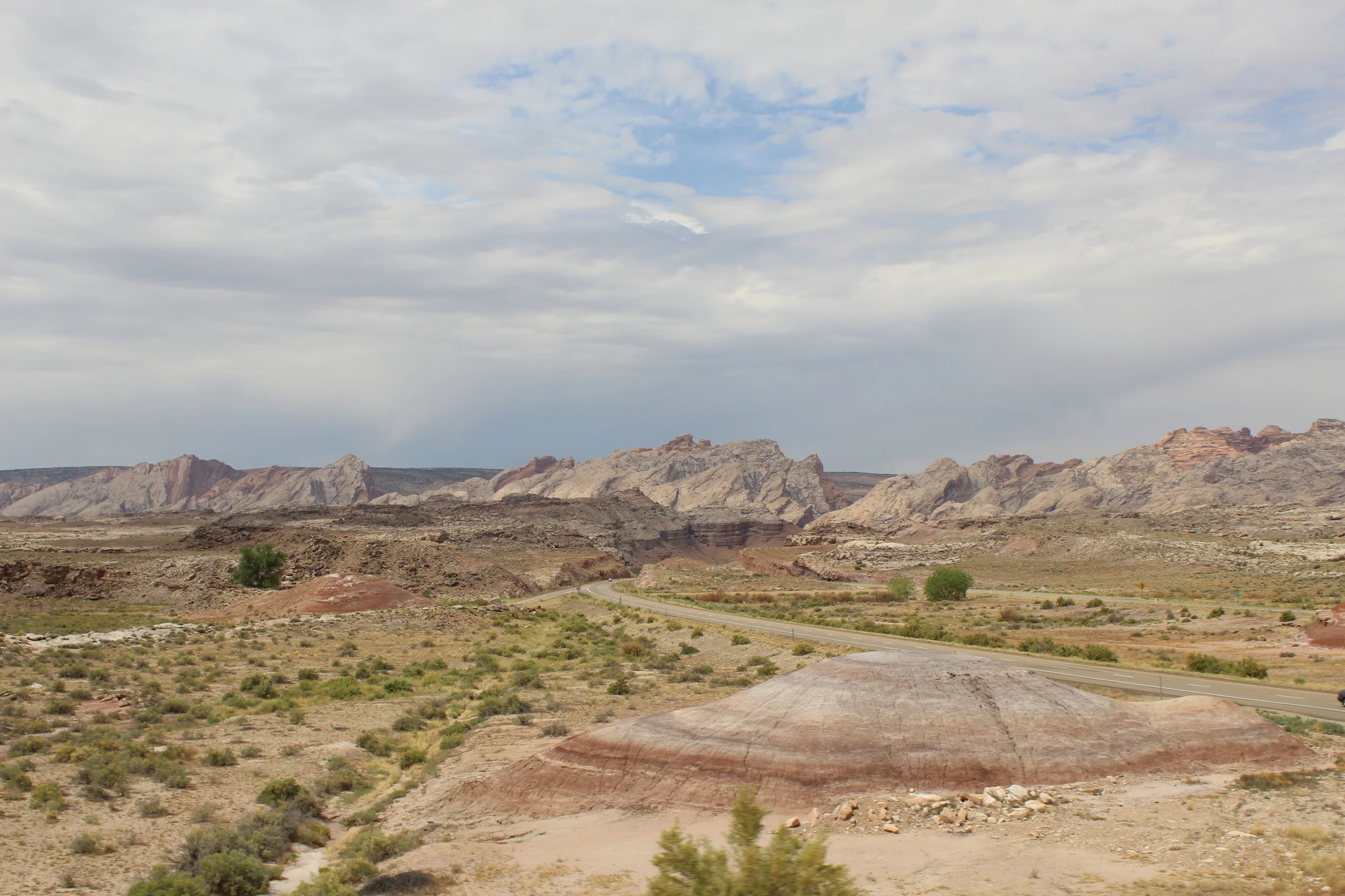
We hit Canyon Reef first … which was really nice as you drive through the canyons and rocks, rather than peering at them from an overlook. It felt personal and accessible.

Navajo Dome, Capitol Reef NP
We stopped at many pullouts, listened to a ranger talk about the petroglyphs left by the Fremont Indian culture, picked free apples in orchards left by a former Mormon outpost called Fruita, and then took off towards Bryce in the late and rainy afternoon, heading south on Rt 12.

The Rand McNally Atlas has no elevation markings on the state pages, other than the occasional peak height. It's my main form of navigation, as Google is often not available, and I prefer paper in my hands and the “big picture” anyway. So my assumption that the upcoming Dixie National Forest was rather flat was a somewhat misguided one.

We climbed up over the 9600' peak of Boulder Mountain while passing through, and saw a number of boondockers and some cattle dotting the rolling meadows at the top. So tempted to join them (despite the cold!), but we went on, though not without leaving our windows down so we could continue to enjoy the divine smell of wet sagebrush … yum!

One overlook near the top, half lit with the last of the sun, had a view of Mt Ellen's 11,500' peak, and the “biggest” vista I can ever remember seeing. Layers upon layers of buttes and trees and mountains and colors and light. Utterly magical. According to the placard there, we were looking at the last bit of the lower 48 states to get mapped, which happened sometime in the 1850s.

Then down the mountain in the gathering gloom, including a couple spots of 14% grade, heading into the large empty-looking blob on my map labeled as the Grand Staircase Escalante National Monument. About which I knew exactly nothing. So why we were shocked to come down off the mountain and find ourselves on a wet, winding, very narrow road between two deep canyons, I'm not too sure. It was par for the course.
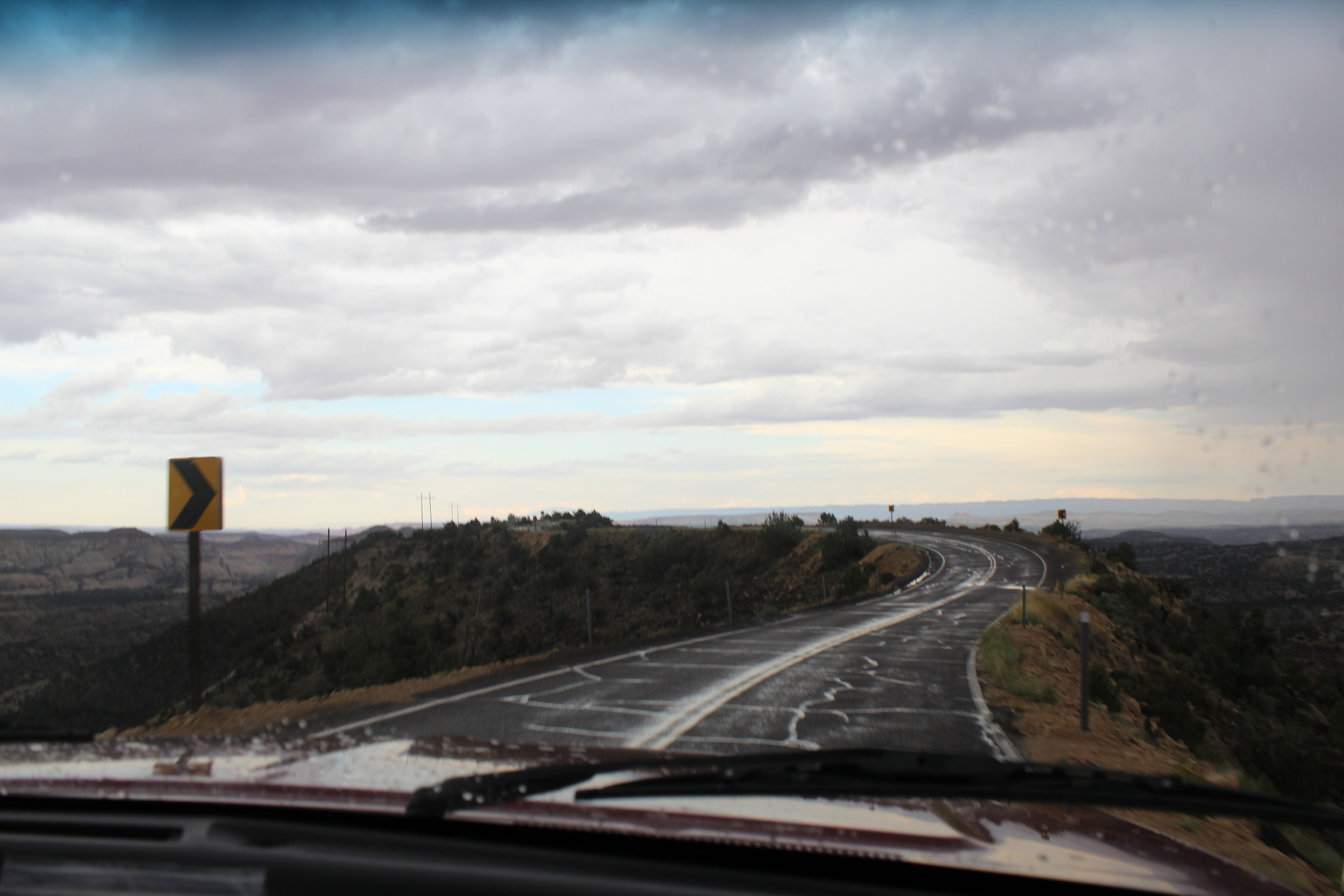
It was visual overload for all of us, but insanely wild and empty and beautiful, though increasingly hard to see. We wound, swooped, curved, teetered (or so it seemed) through the trackless wild, seeing only a couple other vehicles. The only sign of habitation in the next hour was a coffee shop(!) perched out on a promontory over a canyon, but it sadly had closed at 4pm. I don't think we would have fit in their parking lot anyhow.

We climbed our way slowly up and out of the canyons, headed for the next dot on the map that implied people and services, labeled Escalante. The last overlook offered the story of mule trains delivering mail there, in winter at least, as recently as 1942. It wasn't hard to imagine at all.

The road we'd just traveled ...
Matilda purred her way into town (that filter wash made a big difference!) and we found a pricey-but-we'll-take-it RV park that had a laundromat, WiFi, and a paved pull-through … perfect! My journal entry for the day ends with “exhausted and exhilarated”, and that pretty much sums it up. It was an astoundingly full day of strange and beautiful sights, and the fact that it was all surprising made it even more enjoyable. Lack of research meant that the expectations were pretty low, and we gobbled up the beauty we stumbled across without having any regrets over things we missed.

see Flickr for lots more pics for Utah! and Capitol Reef and Grand Staircase Escalante
previous posts : DAY 1 / DAY 2 / DAY 3 / DAY 4 / DAY 5 / DAY 6 / DAY 7